Tuesday, January 24, 2006
Lake Worth to The Bahamas (Berry Islands)
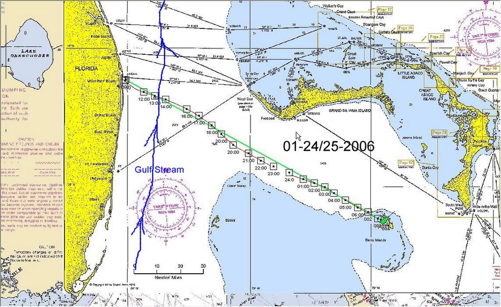
This our 2006 crossing route. This pic shows the actual chart we used, with the times and the red line is also our actual course.
The hardest part is choosing the right time to cross the gulf stream. A river that flows North at 3 knots in the center. Cross it with a wind that blows from the North and you are in S---t! Steep curling seas that could capsize a boat. And at this time of year, most of the winds are from the North.
So all boats listen to the weather and as soon as there is a 24 hr window, we leave under motor to get as far past the stream as possible, before the wind veers North again. You can also see how the stream has veered us in a northerly direction and how we came back south again to our final destination in the Berry islands.
If you click on the pic, you should get a large size.
