Saturday, April 29, 2006
Party Looks
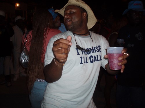
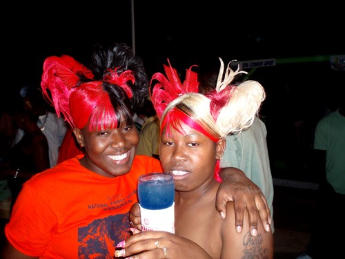
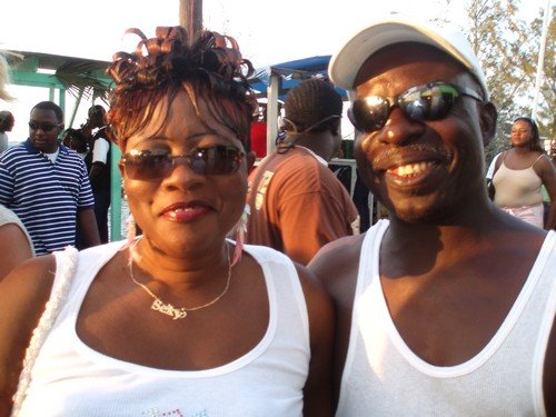
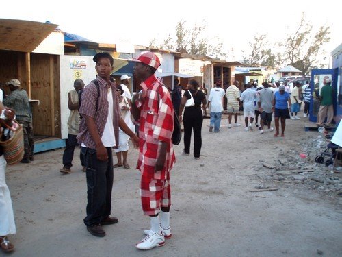
Bahamians love to party! And the ladies like to dress-up! As you can see in the pics, they spare no expense on outfits and hair style.
Rows of monster speakers, Kalik beer and food stands set up for the party serving local dishes, round off the necessities for the festivities.
Wednesday, April 26, 2006
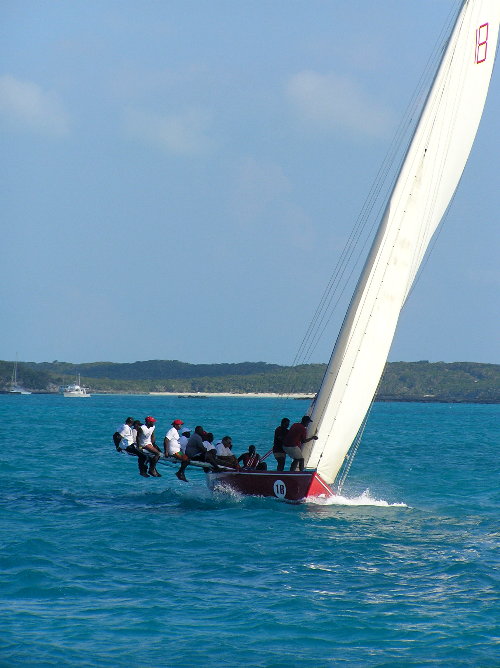
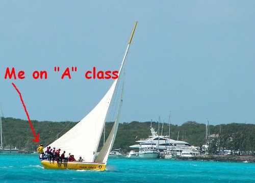
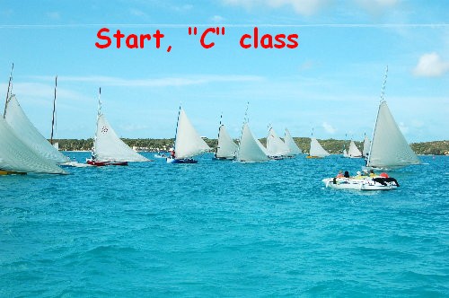
Family Island Regatta
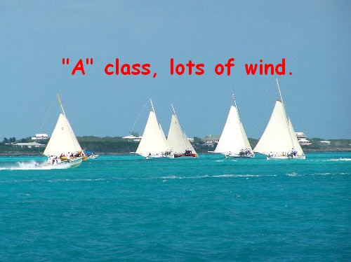
The Family Island regatta is held every April in Georgetown, Exuma. It is the Grand Prix for Bahamian sloops who have competed in their own Island races to come here and vie for the championship. The races were originally started by the government to promote travel by the population in order to spread out the gene pool.
4 classes compete. A,B,C,&D. These boats are kept to a strict style and look, resembling the old sturdy boats that were used to travel and move freight in the day of sail. While logos and sponsorship is allowed on the hulls, the sails must remain free. The sail area is enormous for the size of the vessel, so long boards (Prys) are moved out to one side and the crew sits on the pry to balance the boat so it does not tip over. On the “A” class, it is not uncommon to see 5 crew on each of the 2 prys. The start is from anchor and when the gun goes off, everyone starts to pull on the rode giving the boat headway, while the sail is being raised. Approaching the first mark, it is pandemonium as all these craft try to round the mark first. While “starboard” has priority, “balls” prevail, and collisions and bumping are quite common.
I was fortunate enough to crew on all classes (except D) for the four days.
Tuesday, April 25, 2006
Back to GeorgeTown
After a week and a half, (We could have stayed a month, there is so much to do), we rushed back over a two day trip arriving in Georgetown at nightfall, just in time to participate in the Family Island regatta.
Saturday, April 22, 2006
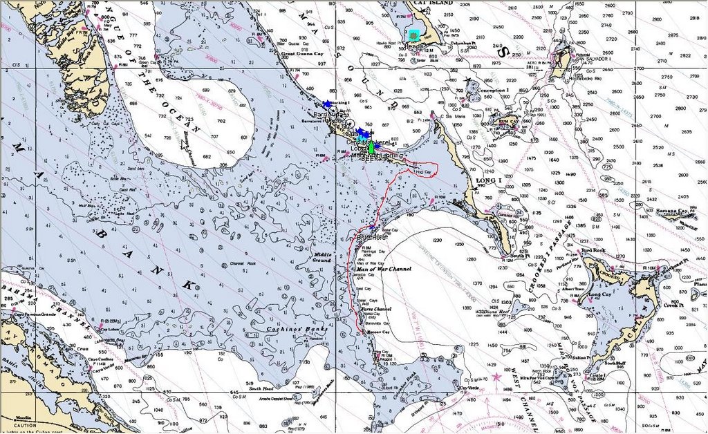
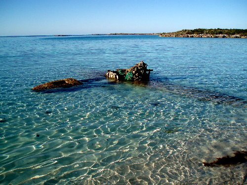
The sinking of the catamaran “Park Place”
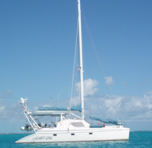
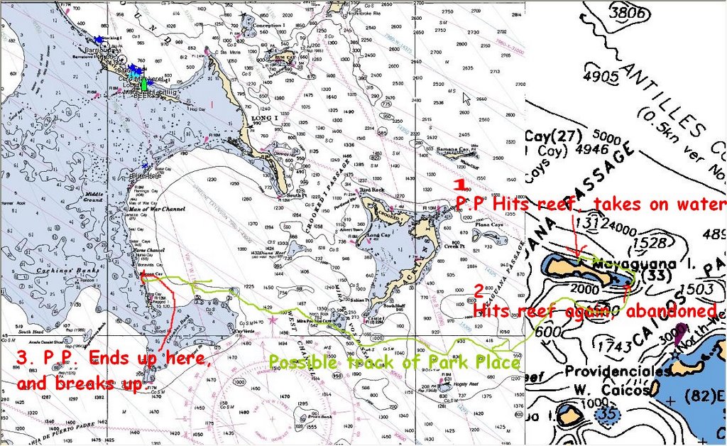
Not a year goes by with out some boats sinking. This year was no different. “Park Place” is a Manta 42. (From now on, I will refer to it as “PP”)
We first heard about the incident on our ham radio. A catamaran called PP was calling in saying that he and an other were in trouble. They had anchored on the Northern shore of Myaguana, hoping to catch a weather window swinging to enable them to sail southwards. It appears that the wind swang to the north earlier than predicted and brought large seas that came into their anchorage. PP made it out into the ocean to safety, but the other cat caught his anchor rode in the propeller and was sent up onto the beach were he was breaking up. PP tried to go in to help but hit something (Coral?) and damaged his rudder and went back out to sea. All this time, PP was on the ham radio giving us a report of his position and condition of the boat. He noticed that he was taking on water faster than they could pump it out, so decided to go around the island and beach the boat in order to get off, but it appears th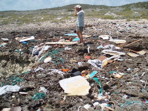 at in rounding the island they were a bit to close to the reef, hit it and sustained enough damage to force them to abandon PP. They were saved by other boaters in the area. PP eventually drifted into the Jumentoes were it was reported spotted by some fishermen, as being washed up on Racoon Cay. These pics show a Manta 42 (sistership), the area of the incident, and the remains of the boat.
Friday, April 21, 2006
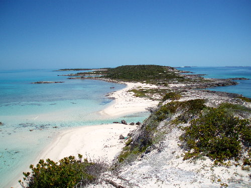
Racoon Cay
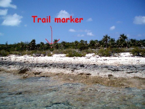
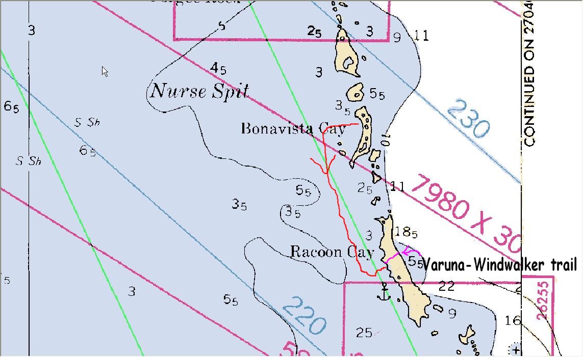
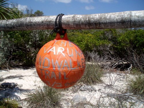
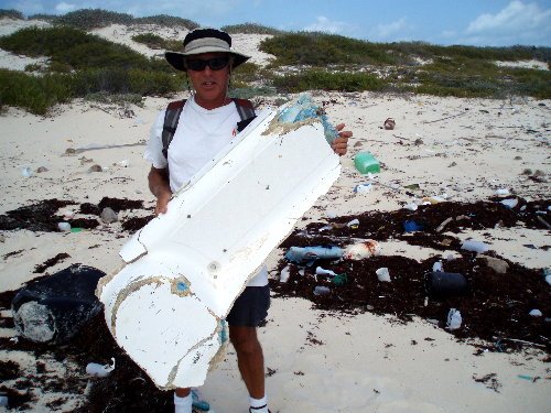
Racoon Cay, southern Jumentoes, 70 miles from Cuba.
Two years ago when we passed by this place on or trip to Cuba, we were socked in here for 7 days because of strong winds. After a day of exploring, we found that the brush was to dense to cross over to the ocean side so with the help of an other cruiser (An& Sandy from Windwalker) we cut a trail over a period of 4 days. (Hence we named the trail “The Varuna-Windwalker Trail”) We used machetes, and a buck-saw. It was strenuous work, but we were able to get to a shore that had rarely been visited by humans. This rewarded us with antique aluminum fishing floats, and many other assorted beach goodies. Little did we know that in the future (2006) we would also be visiting the remains of Park Place. Checking out the trail, we added a float tied to a cross member, so it could be recognizable from the beach. Let’s hope that it makes it through the winter hurricanes.
Also noted in the pics is the reckage of a small plane, of which there are many in the Bahamas. WE figure it probably comes from the drug running days.
Thursday, April 20, 2006
Flamingo Cay to Buena Vista cay
Buena Vista Cay, has a beach that is 1 ½ miles long. Going to the end and back, gave us our daily exercise, and foot scrub.
Tuesday, April 18, 2006
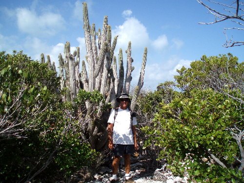
Flamingo Cay
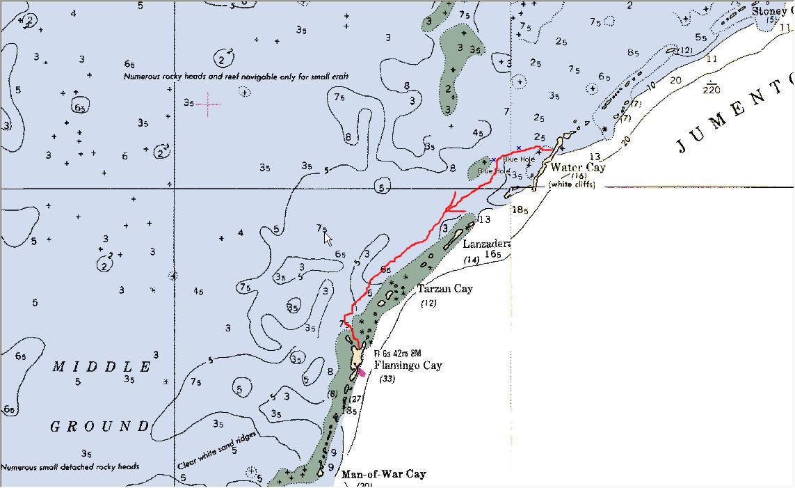
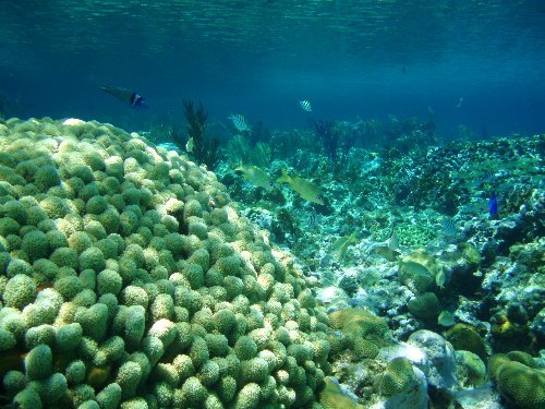
Flamingo Cay.
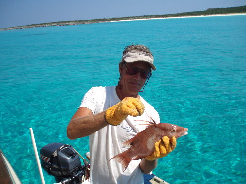
Diving, diving, diving! The best place yet! Tons of fish (sharks, barracuda included) crystal clear water, and I finally shot a Hogfish. The best tasting fish I have ever eaten
Monday, April 17, 2006
Sharks
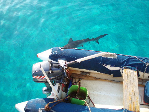
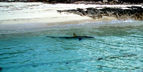
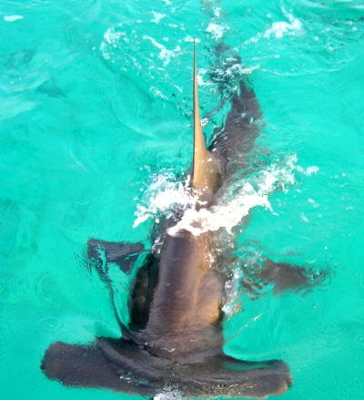
aka Muchuohungriest)
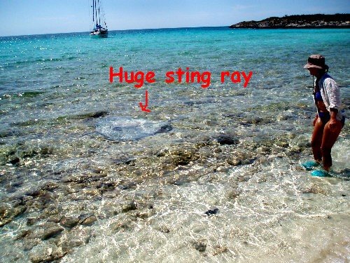
This year we seemed to see many more sharks, especially in the Southern Bahamas. Some are not so dangerous and some are very aggressive. The Hammerhead pic was taken by my son Eric last year from the stern of Varuna. We calculate the length was at least 10 feet. The other pics were taken by myself in the Jumentoes. They are beautifull creatures, but scare the hell out of me.
Sunday, April 16, 2006
Long Island to Water Cay (Jumentoes)
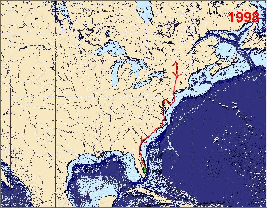
We left early in the am with a buddy boat, Lee and Charlie on Windstar 4. Originally from Halifax, they have been cruising the area since we first met them in 1998 on our first trip south.
Arrived Water cay in the late afternoon and chilled the rest of the day.
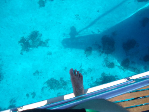
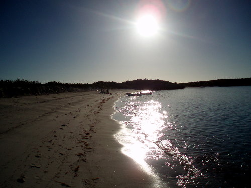
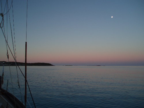
The next day, I was up early and got this shot of the moon, just before the sun broke the horizon. There was also no wind and the water was as flat as glass. Also because the water is so clear it was like looking into an aquarium. In the pic where you see my foot, the water is over 20’ deep! But it looks like only 2’. And of course, I had to shoot the sun setting while we have cocktai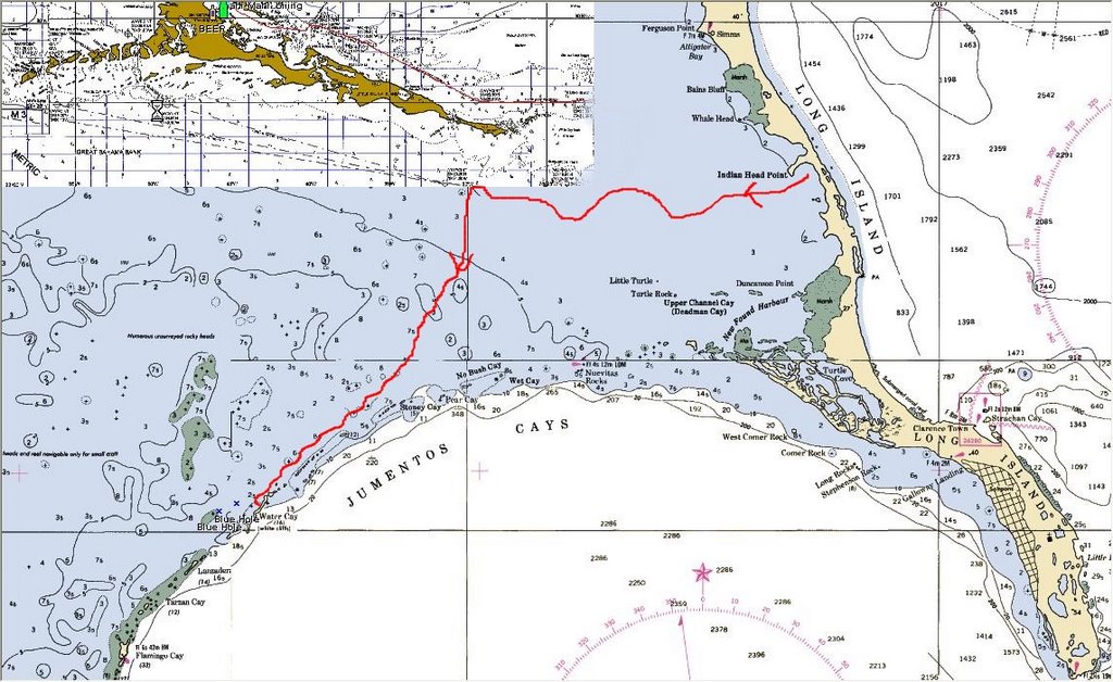 ls on the beach.
Saturday, April 15, 2006
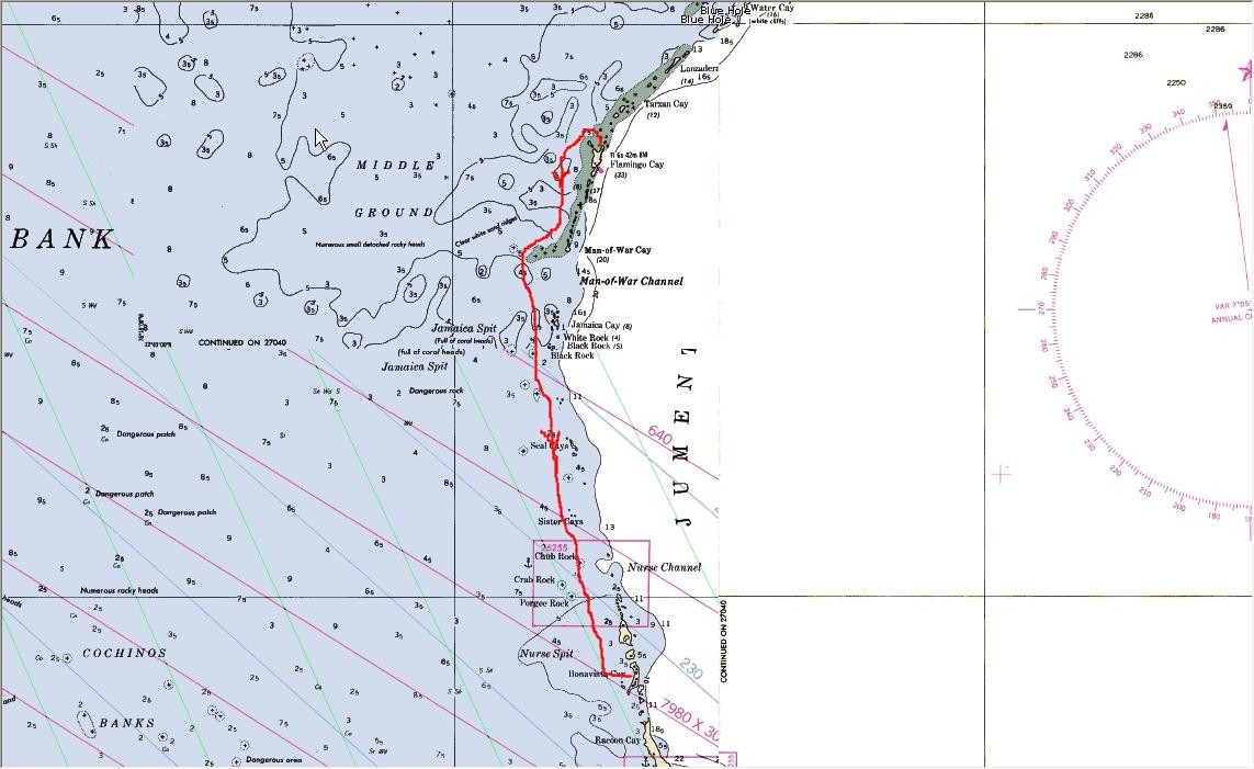
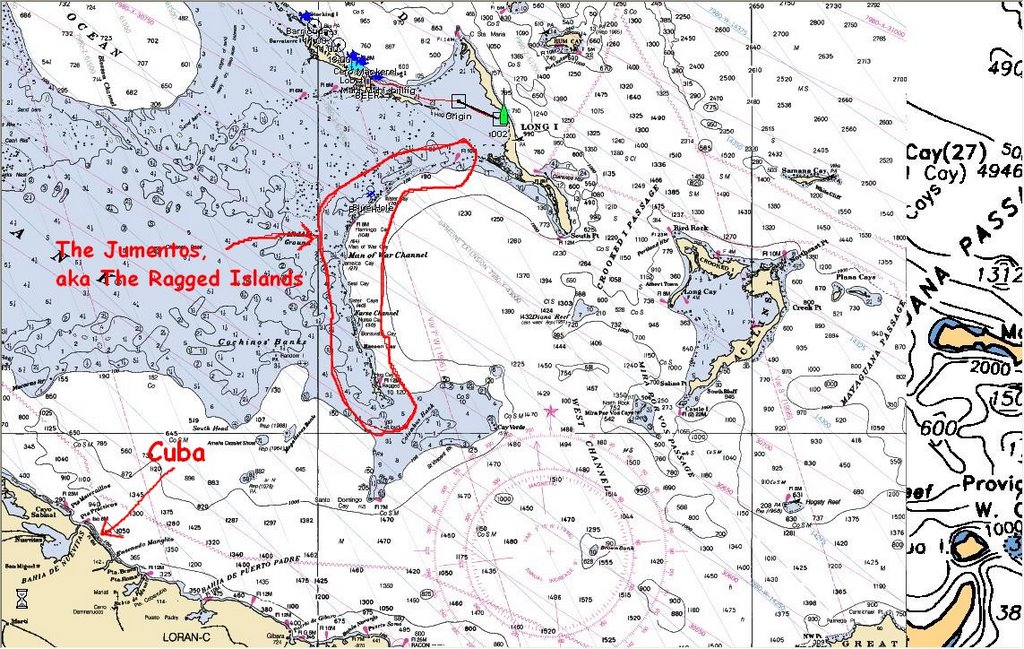
Jumento Island Chain

The Jumento, are a croissant shaped chain of islands approximately 110 miles long that lie at the southern edge of the Great Bahama Bank at the Crooked island passage. The entire chain is often called the Ragged Islands, and are totally uninhabited except for the bottom island at the settlement of Duncantown (pop 60), which is approx 65 miles from Cuba.
The Jumentos are the perfect place for cruisers wanting to get off the beaten path, to visit unspoiled islands free from commercial development, and to enjoy superb fishing,diving and beach-combing.
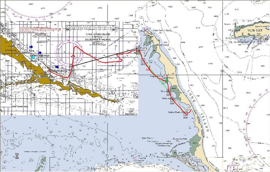
See chart in the pictures below.
Wednesday, April 05, 2006
Kids
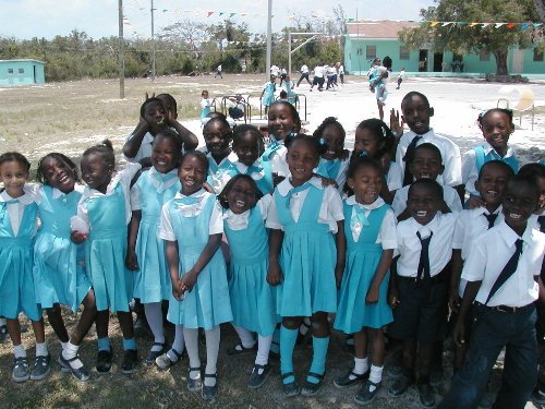
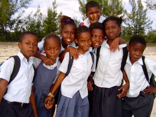
Kids anywhere are great, and the Bahamian kids fit right at the top.
Schools require uniforms (I wish it was the same in Canada) and they have not been tainted by North American marketing practices .
Manners and respect towards adults (and each other) still exists in the islands.
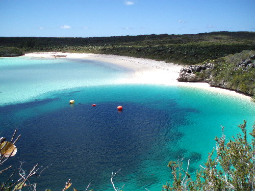
The Blue Hole
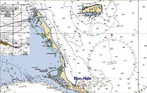
April,2006
Long Island
http://www.verticalblue.net/deans.htm
A stunning blue hole, (The deepest in the world, 600’) surrounded by cliffs on 3 sides is located on this island.
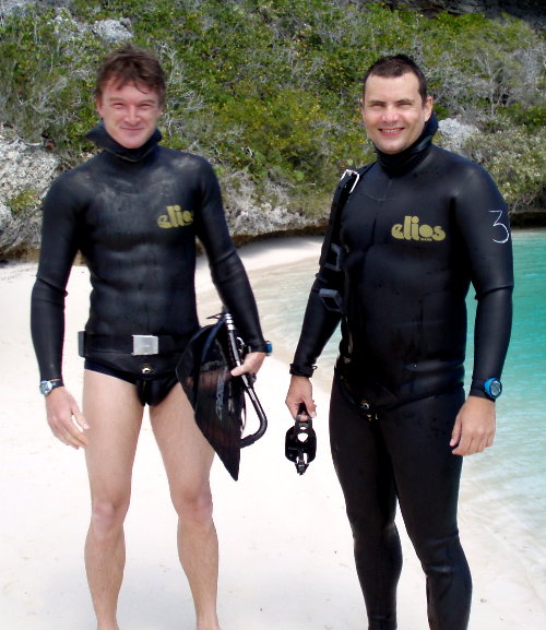
You get to it by hitchhiking from the anchorage. After two lifts, we arrived and met up with two divers who are in training for world records for deep free-diving.
The competition is in Nice, France in May on the open ocean, and they train here since the surrounding reefs make the hole calm and enables them to train everyday.
They dive with only a small mask over their eyes and fins. Nothing else, except suit and weights.
To dive, they hang on the surface for about 15 min, then down they go. They dive to 270’ and are down for 3-4 min!
There is a website for this association:
And one of the divers has his own site:
Has to be seen to be believed!
Monday, April 03, 2006
Long Island
Long Island
We left the day after to go over to Long island, a short 30 mile sail from Georgetown. An island about 1 mile wide and 85 miles long. One road runs the length and you get around by hitchhiking.
Looking at our track, you can see how we changed headings to be able to sail close to the shifting wind. Stopped at Simms, explored for a day then slowly meandered down to Thompson Bay where we are now.
While going to the blue hole that I wrote about in yesterday's letter, we stopped off at a roadside conch bar and found out there was a regatta for junior sailors happening the next day, so we hitched a ride on the appropriate day and were treated to a great event. It was quite windy, but the contest was setup in a protected bay so there were no waves.
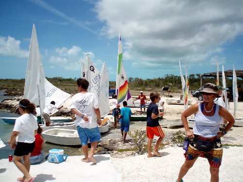
It was a blast to see kids (10yrs-16yrs) sailing a variety of watercraft and putting them through their paces. Of much more fun was the locals who were running the event. If you can imagine a BBQ set up next to the dock, then a bar, then huge BBQ's cooking chicken and ribs. At 15:00, a pick-up truck shows up full of monster speakers and soon a dj is cranking out Bahamian tunes, and the party went on into the wee hours of the night, with people from all over the island coming to join the fun.
During the race, chase boats are helping out the kids who get stuck on rocks or flip over. These boas are 18-25ft Boston whalers with monster engines and a center console. They are only driven at top speed with a guy standing up-right in the front, holding onto a rope in one hand, and a beer in the other. Some times it is a kid driving. Remember thought, that these people grow up on the water, and boats are their life.
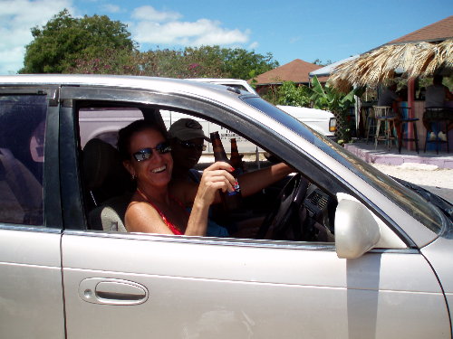
Today, most of the cruising boats have left the bay and we are chilling for the day. Latter we will go to some beaches that we have not seen yet and see if we can find any sea-beans that drift over on the currents from Africa.
What will we do tomorrow? We will decide that tomorrow......, maybe.....
Ahrrrrrrrrrrr
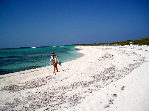
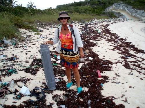
Beaches
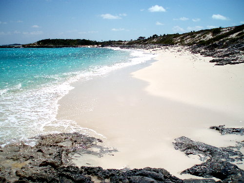
You think all beaches are the same? Wrong........
Some are pristine, and just around a corner on the same stretch, you can have a beach that has a different current and all the junk washes up on it's shore.
Viv is holding a plastic case that contained a sonar buoy dropped from airplanes used to track submarines. After the buoy is dropped into the ocean, the case is jettisoned. After a programed time, the sonar bouy sinks to the bottom of the ocean.
Saturday, April 01, 2006
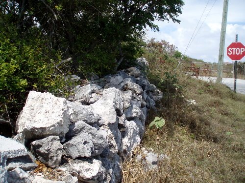
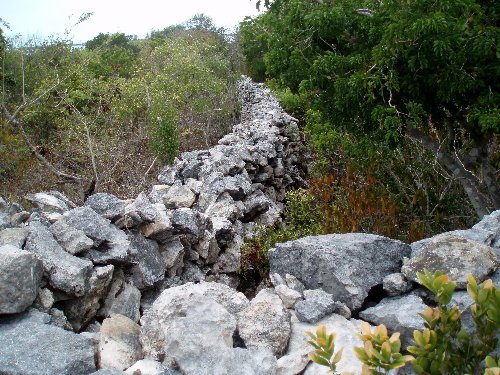
Walls, wals, walls
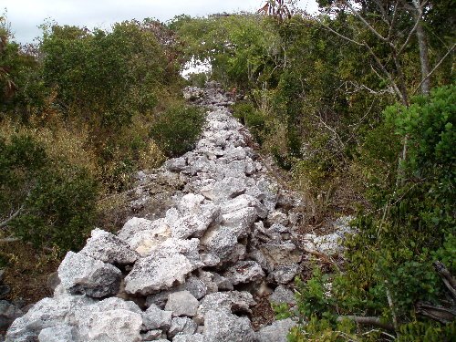
One thing that amazes me in the Bahamas are the walls. On almost every inhabited Island, there are walls that are built of stone that run every where.
They were built mostly by slaves during the time that the Loyalists came here to try and build a better life after the American revolution. (1700’s). Most of the land is overgrown, since it could never support the crops that were planted.
One can only imagine the amount of people it took to make them.